blah blah blah
Shelburne Basins
Length: 1.9 miles out-and-backDifficulty (click for info): Beginner
Elevation Gain: 390 feet (+0 feet on return)
Rating (click for info): 6/10
Height: 20' (main falls)
Source: Pea Brook
Driving Directions:
Trailhead is on Rt. 2 in Shelburne, NH. Traveling east from Gorham, the trailhead is located on the south side of the road, 1.5 miles from the junction with Rt. 16. Look for a pull-off with space for a pair of cars on the east side of a bridge. There is also space on the west side of the bridge. It is 1000 feet west of the entrance to White Birches Camping Park. Click here for a Google map.
About the Hike:
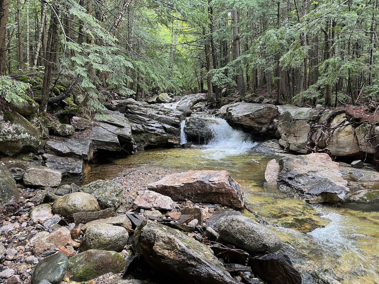
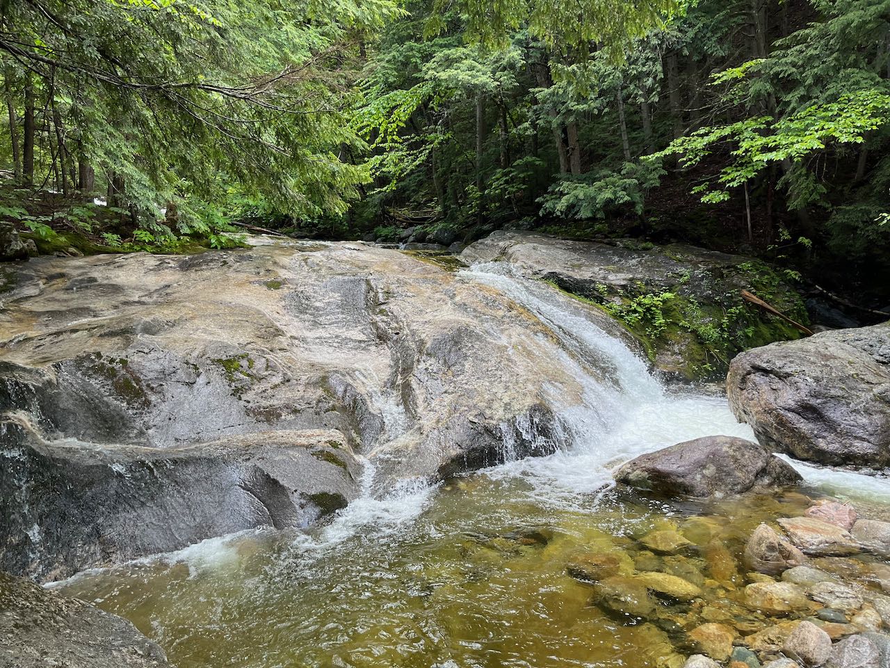
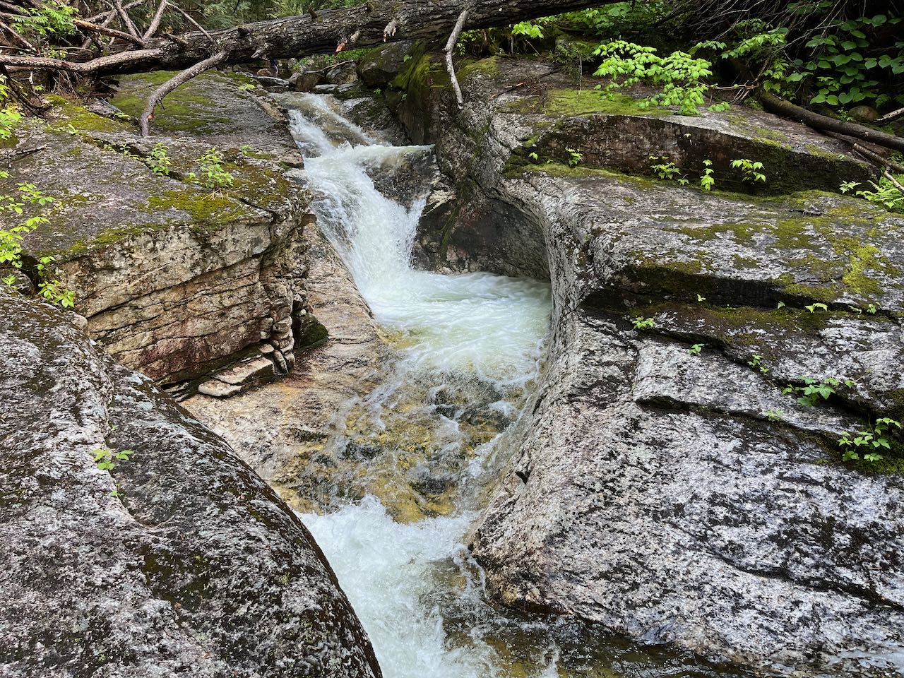
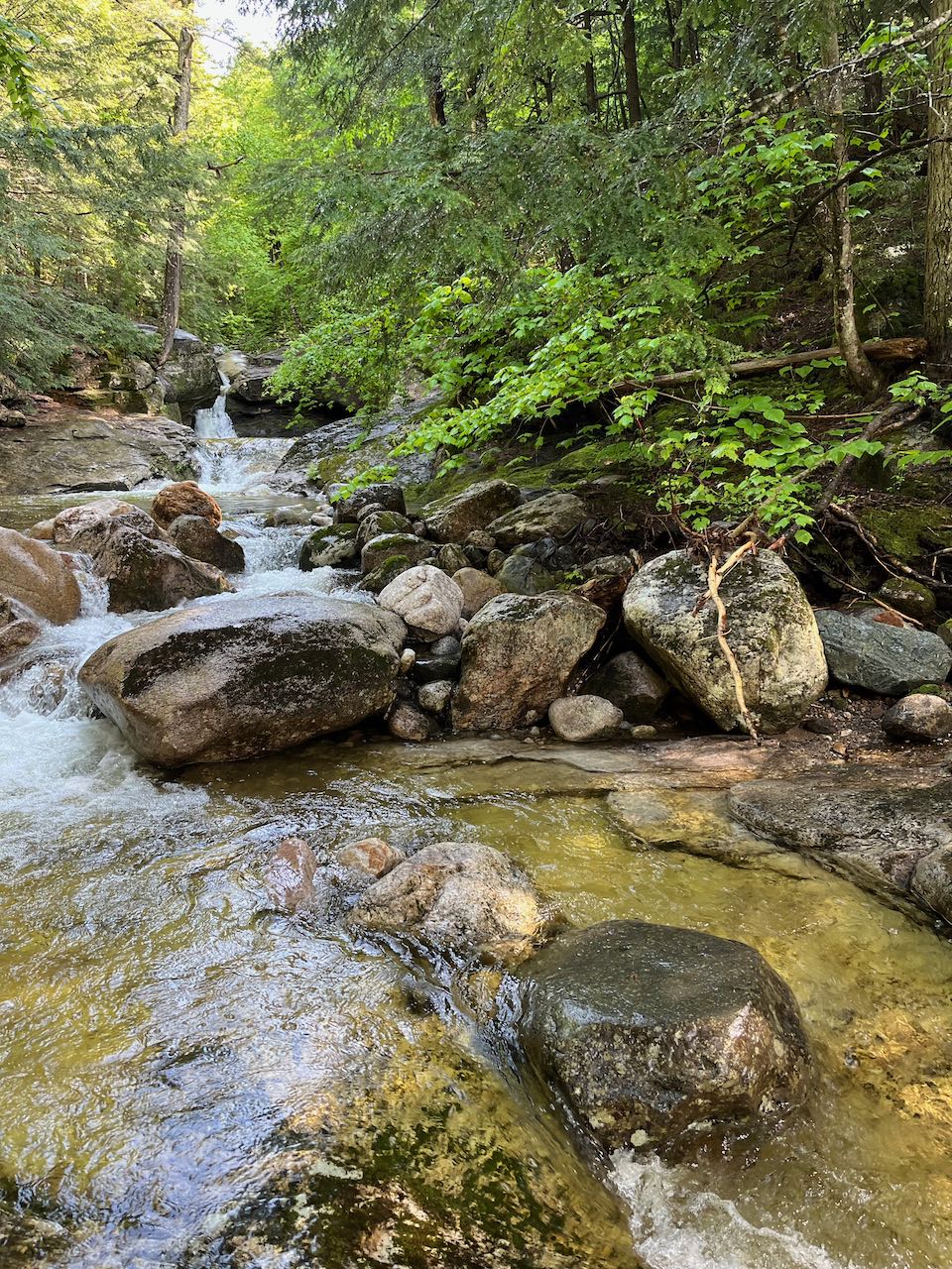
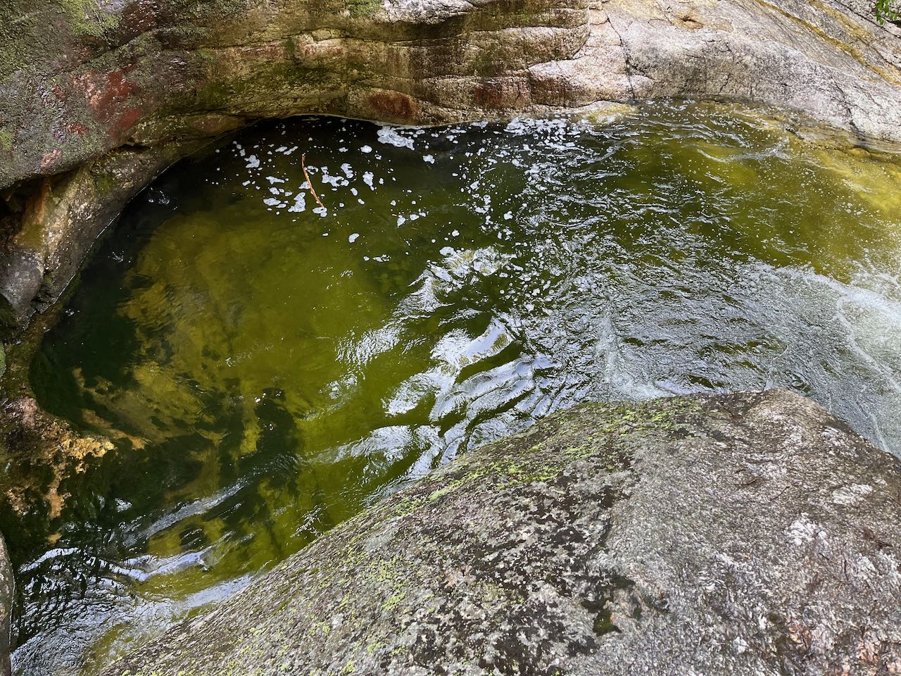
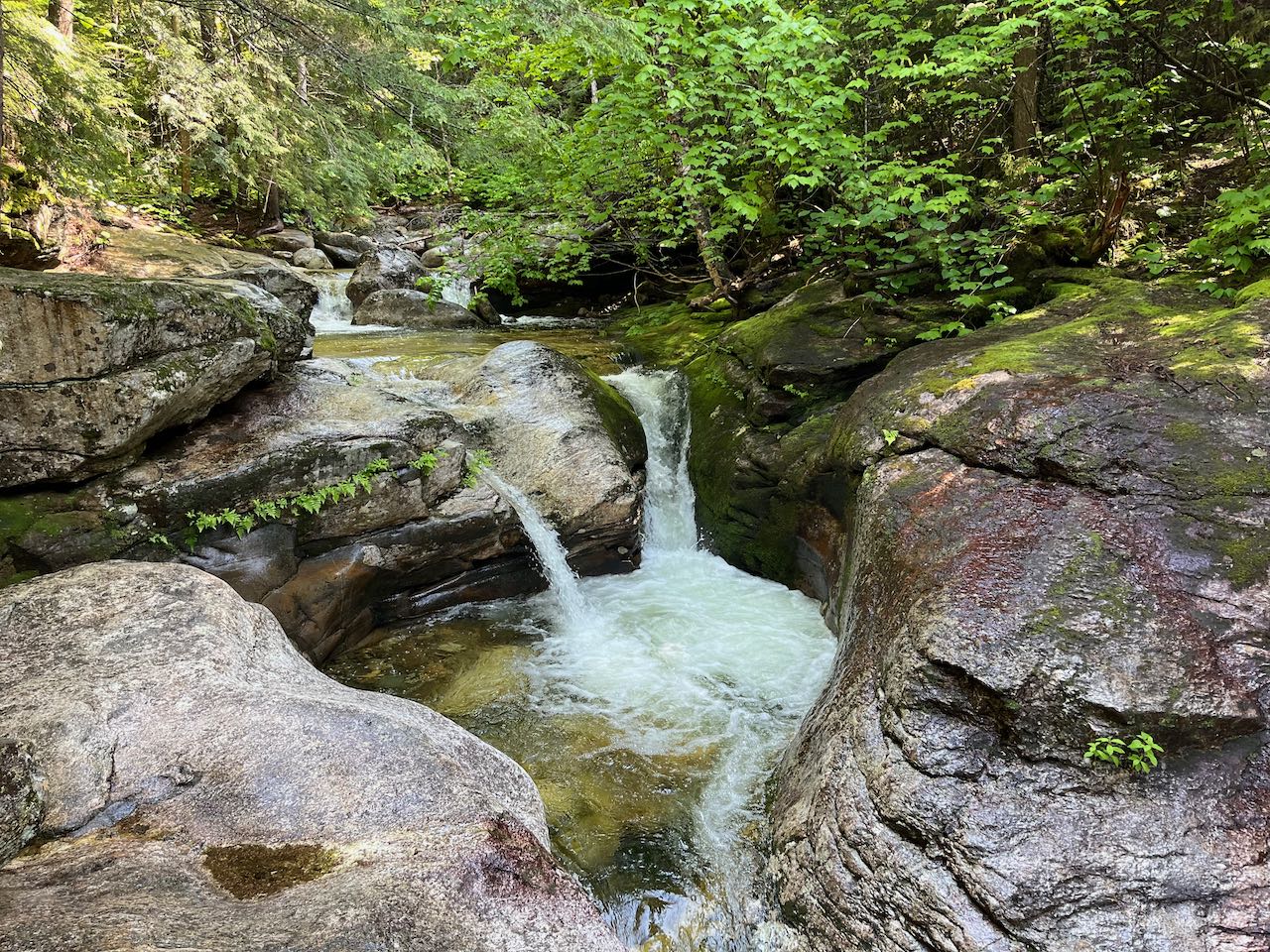
The Shelburne Basins is the local name for a remarkable series of water-sculpted ledges and cascades on Pea Brook in the town of Shelburne. The formation is on par with other water features that draw attention for the dual reasons of scenic beauty and swimming possibilities, such as Franconia Falls and Diana's Baths. The Shelburne Basins receives much less notoriety because it is mostly monopolized by the nearby White Birches Camping Park, which maintains the trail access and sends many of its visitors. It is a simple and easy walk to find the falls, which span over a few tenths of a mile and provide abundant exploration opportunities.
Head into the woods on the unmarked but very clear pathway. In 0.1 miles, cross straight under a powerline swath, where parking for the campground is adjacent on the left side of the trail. The trail passes through a tight corridor of spruces on the other side and continues slightly uphill another quarter mile to a T-junction, where another trail from the campground (not open to the public) comes in from the left. Turn right and follow a wide forest corridor parallel to the brook, which is at a distance off to the right. Not too far past this junction, you'll be able to see the brook through the trees. A faint path leads off to a fine cascade, just a few feet tall, at this point. This small plunge, pool, and ledgy slide is a mere preview of the fascinating formations further up the brook. Hike about 0.4 miles total up the smooth trail to a point where it approaches the brook. Where you see a dry channel of the stream beside the trail, you can follow another beaten path out to a ledgy area with more interesting cascades and rapids. A bit further on the main trail, you will approach the main falls. The trail will rise up onto an embankment beside the top of the mini-gorge; to see it from below, you will need to make your way down to the broad pool at the bottom. From here, you can look straight into the rocky channel as the brook zig-zags swiftly through the ledge. In the pattern of short drops followed by circular bowls, the water swirls around powerfully. At the exit down into the pool, look into the brookbed and you'll notice a deep parabola-shaped carve-out in the ledge. Continue on the trail to get to the highest and most impressive drops. The rock walls are highest here, and the pool in the middle is extraordinarily deep. The uppermost waterfall is differentiated by two separate chutes that pour into the top basin.
Printable directions page